Submit A Local Authority Search
Current Turnaround:
Standard: 3-4 working days once valid
Expedited: 24 hours once valid
Last update: 20 May 2024
Validation requirements
- An application should be submitted as residential OR non-residential
- An application for a search must be accompanied by a plan clearly defining the property or piece of land to be searched and subject of the transaction
- Plans supplied must be as up to date as possible and clearly show the area to be searched in red
- Search applications are usually for one parcel. Please check our parcels of land guidance for clarification if you think you may have more than one parcel. If it is still not clear, we would recommend you send us the plan prior to submitting the request so we can help. Email Land Charges with your plan
- Double check the fee required
Fees
Please see our fees page.
Payment methods
- Bank transfer
- Debit/Credit card
How we will use your data.
Ashford Borough Council (ABC) is the data controller for the personal information you provide. ABC’s Data Protection Officer can be contacted at FOI@ashford.gov.uk. Your information will be used to process local authority search requests/enquiries. Processing is being conducted relying upon the contract legal basis. We will not share your information with any third parties unless we are required or permitted to do so by law. Your information will be retained for 12 years. For more information on your rights please see the council’s privacy statement.
Parcels of land guidance
Normally a separate requisition should be made, and the fee paid, in respect of each separate parcel of land. However, one requisition (or one personal search) may cover more than one parcel under Rule 11 when it is required for the purposes of a single transaction and the several parcels have a common boundary or are separated only by a road, railway, river, stream or canal. "Parcel" of land in this context means a piece of land in separate occupation or separately rated at the time of the requisition for search.
Jan E Boothroyd - Garner's Local Land Charges, 13th Edition, (c) Shaw and Sons Limited 2005
We will therefore only charge an additional parcel fee if the land (parcel) has a common boundary to the parcel being searched and it is one transaction. (With the exception as stated above regarding road, railway, river, stream or canal). If a common boundary is not present (other than with the exception) a separate requisition will be requested.
Please be aware that ownership of land does not have any bearing on the charging of parcels.
Should you have several plots to search, we suggest that you email the plan to the local land charges department so that we can confirm how they need to be submitted and the fee required.
Tier guidance
Residential
Rated and occupied as residential at the time of search. Does not include agricultural/derelict buildings with planning permission for conversion.
Non-residential
Land, commercial units, garage/s when being searched without residential property, garden land without the inclusion of a residential property, agricultural/derelict buildings with planning permission for conversion but not yet converted.
Submission Methods
| Method | Requirements |
|---|---|
 |
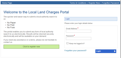
We know how confusing technology can be and have therefore worked hard to ensure that our ordering system is SIMPLE. We've also put the system through its paces to ensure you get instant satisfaction and an immediate, noticeable difference in speeding up the request process. Your search in your hands! |
 |
National Land Information Service (NLIS) NLIS is a government initiative which carries the sole mandate of providing electronic official land and property information held by all Local Authorities in England and Wales, as well as other official sources of data, including HMLR, the Coal Authority and water companies. The NLIS Hub acts as a gateway for conveyancers to access land and property information through one of the NLIS Licensed Channels listed below. The NLIS Hub is regulated by Land Data. For further information on how to order NLIS searches visit the website. |
| Email: | land.charges@ashford.gov.uk |


